We would like to visit RED SAND in Riyadh. Any ideas? Activities? Where is the place.
Thank you
Red Sand
141
8790
Katelol wrote:We would like to visit RED SAND in Riyadh. Any ideas? Activities? Where is the place.
Thank you
It's an area about an hour's drive outside of Riyadh (North East, I think) You can hike the dunes there, pack a lunch if you want. There's usually some of the locals hanging around with 4 wheelers that they'll rent to you for a half-hour (or more) to ride around. That's about it. It's just desert but different in that it's actual sand dunes, and that sand is red.
141
do you know where exactly it is? I will have to hire a driver so I need more details.
Thank you
544
Route:-
1-Take Riyadh-Makkah highway…..pass down through the cut escarpment.
2-Cross the old makkah road…go straight…..Now you are in Muzamiyah area.
3-Cross the 2nd over head bridge(exit-6). you'll see a petrol/gas station on your left, you have to reach there after making a U-turn.
4-Make a U-turn from the 3rd overhead bridge.
5-Now you face Makkah-Riyadh direction, look for a link road at your right sign-posted (Arabic-Lake Gharara) just before the petrol/gas station.
6-Take this link road, going zigzag for about 6-7 kms through resthouses surrounded by sand dunes.
7-At bout 6-7 kms look for a desert track at your left…..take the track.
8- After about 500meters you'll see what you were looking for…….if on 2wheel drive…..stick to the track.
9-The track gives out a branch to the right…going up to the sand dunes. The main track leads to the lake bed. If the lake is dry enter the first gate…and drive through the lake bed…………..and Explore. ENJOY!!!
Read more: http://www.virtualtourist.com/travel/Mi … z1qACRxYRg
141
Thank you very much
140
Not sure of the directions you just gave. The last time we went to Red sands, it was much more simpler. Maybe I am wrong and what you have is an alternative route.
1. Take the Makkah Highway. pass down through the escarpment
2. As soon as you reach the plain, look for an exit on the right with a signboard saying oosar al muqbel or something like that (it has been sometime so I forget) which which will take you to the left.
3. After you drive for a while, you will see a power sub station on your left, take the right opposite it.
4. Keep driving for about 10 mins and you will see a big section of sand on your left with lots of quad bikes. You simply cannot miss it.
5. You have reached your destination
saimans
26 March 2012 09:09:11
0
I dont know the route, But i visited this place once and had my first hand experience of driving an SUV in the sand/dunes. Really great feeling....
2
If anybody have GPS coordination and is it recommended to drive with 4x4 vehicle
Thank you
201
this might help
https://maps.google.com.sa/maps?q=24.40 … a=N&tab=wl
2
Easy bro don't be afraid.. Just get a car and go, can be simple car no need for 4x4.
Take the directions shown above by someone else...
To complement I should say..based on googlemaps for easyness..
Take jeddah road (which is mecca road, the same).... Pass the escarpment as mentioned. To know that you are close you will pass first a check point, which is recognized by the constructions at both sides of the road, like two towers and in the middle a big hand with a sword. Go googlemaps (or google earth) and is easy to find just following jeddah road.
After this comes a downhill pretty cool btw, this is what they refer as passing the escarpment. You can make a stop before or after (just see some simple exits, dont be afraid are no roads just parking spots, you can come back to main road easily) to take pics, if you wish.
Passing the escarpment keep going, like bout 10 minutes or so until you see what they called the Oosar al Muqbel sign. In googlemaps you see it as a clover-shape" intersection, easy to see is the first and maybe only one in many miles. So in clover shape "bridge" you take the second exit..you will be sure because huge sign says "Oosar.... turn right" so keep going and don't mind of the curvature of the road ...you will have confidence when you see a huge sign that says "Nassah" (or smthg like that I forgot, other posts have the same name", it shows that you have to turn right so you follow it and turn right and then go straight ahead until some sand starts to appear...if you see sand you immediately will start to see quads at your left. Dont stop in the first quads keep going until the sand have cool hills and stop there...
Rent the quad, bargain... ask for 80 or 90 SAR no more for one hour. if you make to 50 is ok also  . Then just go to the top hills.. If they don't allow you to go then say sorry i will look for other bedouin...
  .... anyways just go even if there is a fence pass the fence, because the fun is in the top hills. just get lost in the top at high speed .
And to make it easier...just go to flickr grab some cool pics of this place and in the pics you see the GPS coordinates, tap the coordinates on your phone and is done
1
I think searching by Polar Coordinates is the simplest to get thru there, have a look in Wikimapia.org and you'll find the way,. you can see the roads, streets and highways. No need a car that has GPS and no need to hire a driver.
This is the coordinates:
24degress 21' 42.17"North
46degrees 21' 32.15"East
..and we proved it to reached that place
25
Hi...
This (24°24'17.8"N 46°14'30.1"E) is not the location for Red Sand.
We went there yesterday but nothing was there.
Can someone give us the exact google map coordinates for Red Sand?
Many thanks
47
https://www.google.com.sa/maps/place/Ri … 46.6752957
Check this...
97
Hmmmmm....
SE of Riyadh:
ahelpfulsaudi wrote:this might help
https://maps.google.com.sa/maps?q=24.40 … amp;tab=wl
West of Riyadh:
aftabv wrote:https://www.google.com.sa/maps/place/Riyadh/@25.131186,47.6272845,5764m/data=!3m1!1e3!4m5!3m4!1s0x3e2f03890d489399:0xba974d1c98e79fd5!8m2!3d24.7135517!4d46.6752957
Check this...

1129
Since it is located as shown above, all you can do in red sand are the following;
Have fun with sand dunes;
Ride a quadbike;
Enjoy the red and mountainous sceneries;
Have a bbq;
And chill!
Subscribe to this topic
Articles to help you in your expat project in Riyadh
Television/Cable Networks in KSA
Well i wanted to give you a guide about the televsion networks which are available in KSA.

Things to see and to do in Saudi Arabia
Saudi Arabia is the biggest country in the Middle East. Its growing population and the exponential expat community ...

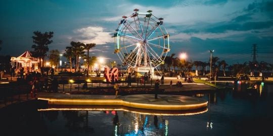
Things to do in Riyadh alone or with your crowd
Riyadh is one of the biggest and most beautiful cities in Saudi Arabia, with quite a bit to offer to expats in ...
Leisure activities in Riyadh
Riyadh, the capital of Saudi Arabia, has a lot to offer, even though it is difficult to give you a precise list of ...
Safari Resort
Safari Resort, located about 70 km from Riyadh driving west on the Makkah Highway is a fabulous location for ...
Golf Courses In Riyadh
This information is courtesy of Maserman


Open a bank account that suits you
Discover the best international banks to manage your money securely.


"