Hi, Can anyone tell me if a site exists to find the postcodes for different places in Mauritius? Thank you
Post code Mauritius
Naomi adriana
15 July 2015 09:32:48
1
Shimotsuma
15 July 2015 09:36:06
26
EVitrac
15 July 2015 11:42:13
14
Yes, See : http://www.mauritiuspost.mu
It's listed by region, city, neighborhood...
barbara torrance
15 July 2015 12:07:55
0
Talking about areas. Do GPS systems in cars work in MU?
seedeur
15 July 2015 16:58:18
590
more or less
not all the streets are listed
Alain Bosquet
16 July 2015 07:12:29
1
Hello, yes a site does exist.
mauritiuspost.mu/products-and-services/post-code-finder
Here is the link where you can download an application which allows you to find the postcodes of all places in Mauriius.
reefcube.mu/en/download-postcodes-mauritius/
iJulien
19 July 2015 16:48:01
1442
barbara torrance wrote:Talking about areas. Do GPS systems in cars work in MU?
Postcodes are less accurate than in the UK over there so you can't rely on typing in a postcode to get to your destination 
barbara torrance
19 July 2015 18:59:40
0
GPS in Mauritis depends an what maps you buy from say Garmin or TOMTOM the main providers
Tomtom seems to mhav looked at several images such as satellite and the mapping adata as it clues many roads it thinks are roads when in fact they are tracks between sugar cane fields. You have tomb careful as one example in tomtom says the B34 road goes from Creve Couer over the mountain to ST Pierre . in fact it is a dirt track and very narrow when it get to the end of the village and I would not take my car any further , it was not a problem for me as I got some nice photos of Pieter Both mountain from a viewpoint on a public road which is probably as cllose as you can get by car anyway
barbara torrance
19 July 2015 19:07:15
0
Thank you to all who have answered. Are road maps better and more relevant
barbara torrance
19 July 2015 19:14:52
0
The tourist maps etc are Okay for the Main roads however say to visit some areas you need to have a good map and even with the faults of say TomTom and Garmin they do at least have good route planning for places of the main roads such as Domaine Anna a well know restaurant between Cascavelle and Flic en Flac.. Mauritius is not very big and there are basically 4 or 5 main roads from North to South one on each coast and the Motorway in the middle and a couple each side of the motorwary such as Beu Bassin RoseHill Quarte Bornes Vacaos or Moka St.Pierre to Quartier Militia and onwards to Flacq. There are less roads of great significance running from east west as you have the mountains and National Park blocking many places where routes could exist.
iJulien
19 July 2015 19:30:36
1442
When I was a tourist I used a tourist map and my advise would be to stick with satnav: TomTom, Waze or Google Maps. Tourist map (including the one from the reputable IGN) might get you into private/closed roads and won't give the quickest path from A to B.
Rosiewestie
21 July 2015 20:59:33
593
I brought my TomTom with me and only used it twice
The first time it insisted I turn left into the sea and the 2nd time it took me deep through the sugar canes - I packed it back away and just use a map, if I get lost I just look for an area I know how to get home from i.e. Rose Hill or QB, but then I often get lost, but as the Island is small I usually find my way home eventually.
I have often thought about buying a local GPS system if there is one, but as I said I usually manage with a map 
TamarG
22 July 2015 00:41:11
30
Download detailed Google Maps on your phone for the area you plan to travel in before you set out. We find even though we're offline once we're in the car that if you've done that, detailed maps will still come up and even your location on them shows up!
Works for both iPhones and Android hones btw.
Cheers,
Tamar
Wäller
22 July 2015 11:13:59
79
I am using the app "here" on my phone with openmaps...its ok but sometimes it takes a long time until GPS has grabbed my position. So you wait and wait and wait until they lady is telling you the next corner. Which you might have passed already. But when you take an earlier turn as expected from the system she might tell you once to turn around but seconds later has already a new route calculated.
Beside this, If you get lost in Mauritius, just drive downhill and then follow the coast line until the next decent sign to know where you are. 
barbara torrance
22 July 2015 13:37:52
0
Tomtom roads are usually coloured as to their importance certainly a road leading to the sugar cane fields would be in white I think.
The reason for this is that I think they took satellite images and created the road maps from them as many of these white roads especially in the countryside are intact 'farm tracks which do look like a road to a satellite.
What it needs and I have made a start myself is to rub these tracks off the map by making map corrections and send them to tom-tom for all to share. The benefit of this is that you do not have to personally correct the whole of the Island yourself but do a little at a time , send them in and get your corrections verified and other peoples and then we all get better maps.
I can give a good example is that at Cascavelle the turning left as you come from Flic-en-flac does not yet include the re-alignment and the small road that now leads to the international School . When I have time next month I will make the correction and include the school as a point of interest as people may want to find the school using TOM TOM.
Rosie please do not leave the TOM TOM in the cupboard learn perhaps on how to correct maps ad we both can help each other and everyone by making the updates
Rosiewestie
22 July 2015 19:50:00
593
Rosie please do not leave the TOM TOM in the cupboard learn perhaps on how to correct maps ad we both can help each other and everyone by making the updates.
Believe me you would not want me correcting any maps, I am so rubbish at maps and directions;)
jkev
11 December 2015 09:50:48
139
Just to mention that having had a Garmin GPS with a hire car I found it worked well. It was good to find locations and also some shops/hotels/etc. by name. I struggled to buy one in the UK for my personal (and visitor) use and had difficulty finding one to buy here and then found that you can purchase one from the Garmin shop in Tamarin.
Subscribe to this topic
Articles to help you in your expat project in Mauritius
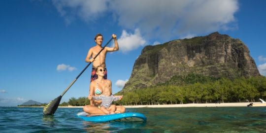
Leisure activities in Mauritius
Mauritius is a lot of things, but it is not boring! You'll always find something interesting to do, whether by the ...
Hash House Harriers - walkers and runners
For anyone who likes walking or running, and being social afterwards, the Mauritius branch of the Hash House ...
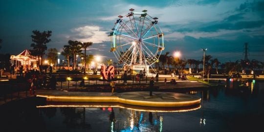
Republic of Mauritius, Small Paradise Archipelago
There are so many nice and beautiful islands or archipelagoes on this planet, and one of them is Mauritius and ...

Driver's licence in Mauritius
Mauritius has a well-developed public transport network, although the frequency and working hours might not work ...

Banking and Finance in Mauritius
Opening a bank account in Mauritius can help you in many ways, including to receive your salary, pay your monthly ...

The health system in Mauritius
Health is a major issue when moving abroad. Are expats eligible for the Mauritian health system? What are the ...


Open a bank account that suits you
Discover the best international banks to manage your money securely.

"